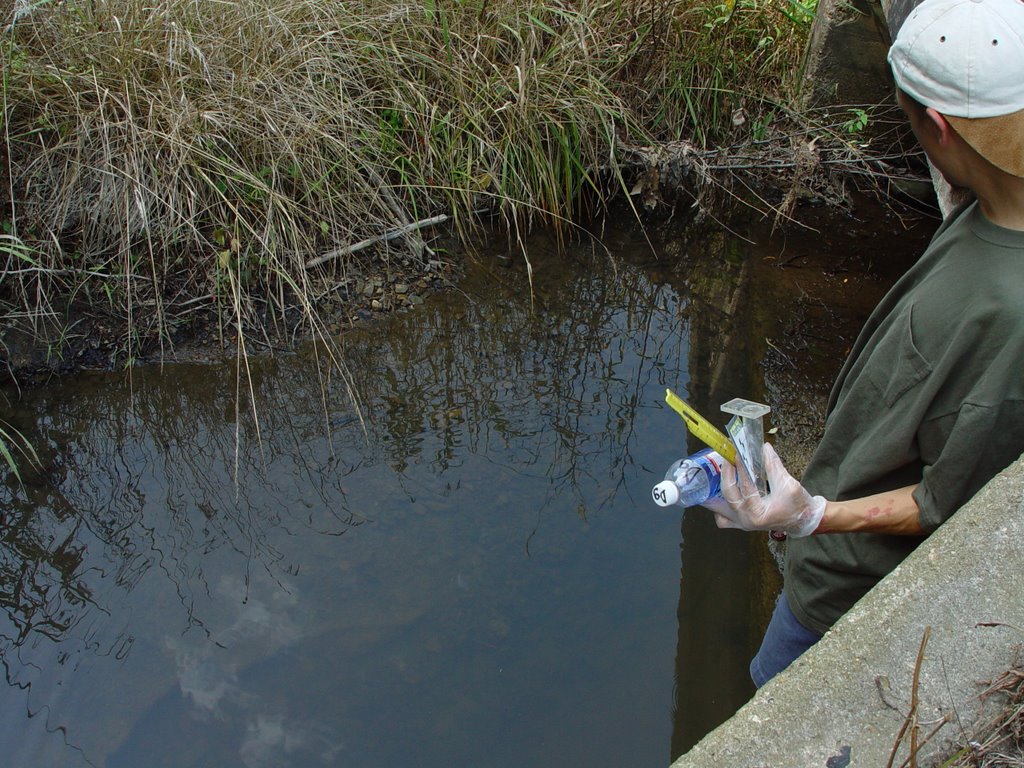
July 13th field work
Field Data: Scouting and Water Testing in New River Watershed
July 13, 2006
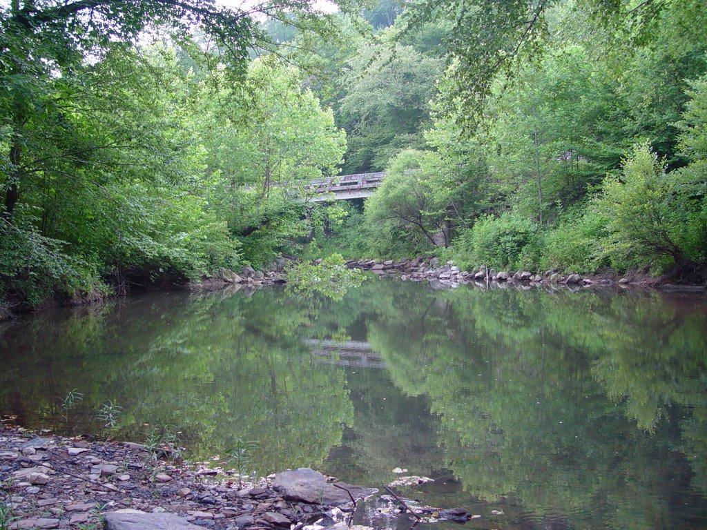
From Knoxville we headed North on 75, exited at the Royal Blue exit and headed West on 63. Site DA is located off of Jakes Branch Road, on the right hand side approx. 7 miles west on 63. Site DB is located on Jeffers Road, on right hand side approx. 15 miles West on 63. Approximately 18 miles West on 63 the river runs under the road and we pulled over on the right hand side to collect sample DC. We then turned South on 27 and collected sample DD from a river that passes under the road approx. 1 mile down. About 2.5 miles South on 27 we crossed the “Colonel Joe Cecil Bridge” over the New River and collected sample DE. We continued down 27 S , through Elgin and past Junction with 52 and pulled off near Robbins (directly before the “Sunbright 9” sign) on the R side of the road to collect sample DF. The next sample (DG) was collected about ½ mile South on 27 from DF where stream passes under the road. Sample DH was collected from Wolf Creek (there is a sign on bridge) approx. 10 miles down 27 S. At this point we doubled back slightly and turned on Brimstone Road. If you are headed South on 27, the turn is on Left, if headed North it is on the right. Cross first bridge over Brimstone Creek. Turn Right at the T-intersection and RR sign (note: taking this left allows numerous access points to the New River). We collected sample DI from bridge approx. 3 miles from the Right turn at the T-intersection. If you turn left at site DI headed past the truck trailers and up gravel road you find an old mine site with a sediment pond and evidence of a landslide. If you continue down Brimstone Road from site DI you will come upon a gravel road on the Left hand side that leads to active logging and mining. The road is directly after the first “big” bridge. The last mine site is about 1 to 1.5 miles down this gravel road, you can turn around past the old coal tipple and RR car. As we came back down this road towards Brimstone Road we stopped to collect sample DJ from creek running on Right hand side of the Road.
Site: DA
Bottle: DA
Pictures: 27-32
GPS Coordinates: N 36 deg 24.034
W 084 deg 07.293
Alt 1227
Speed: 1.5
Temperature: 22 C
Turbidity: 15 JTU
Location: On 63, approx. 7 miles West from Junction with 75. Turned Right on Jakes Branch Road and creek runs under road in about ½ mile.
Appearance: The water is clear. There is some sediment on the bottom of stream, but not as bad as we’ve seen
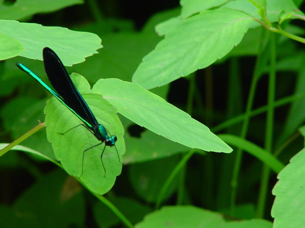
Animals: black butterflies, black dragonflies with green wings
Plants: kudzu, wild daisies, water grasses, milkweed, maples, poplars, red sumac, wine berries, jewel weed, jopie weed, princess tree
Mileage: 101,748
Notes: The road is currently being repaved. There is a medium size garden near creek on right hand side of road and there are a few houses near by. We asked permission take collect a sample from private property from a resident standing in their yard.
Site: DB
Bottle: DB
Pictures: 33-35
GPS Coordinates: N 36 deg 24.278
W 084 deg 27.028
Alt 1227
Speed: 2
Temperature: 22 C
Turbidity: 10 JTU
Location: Turned Right on Jeffers Road, approx. 15 miles West on 63 from Junction with 75. Travel about ½ mile down Jeffers Road and pull off to right. At this point you are under a bridge on 63. There is a RR bridge crossing over water and under 63 overpass. There is a dumpster on left side of Jeffers Road and a pile of about 30 old tires.
Appearance: Water is clear but heavily sedimented. There are numerous dead bush and a lot of dead grasses on the bank of the creek. There are some rusty RR (?) pieces in the water as well as garbage and a big tire.
Animals: none noted
Plants: maple tree, deer berry bush, grasses that are dead and alive
Mileage: 101,757
Site: DC
Bottle: DC
Pictures: 36-41
GPS Coordinates: N 36 deg 24.990
W 084 deg 30.262
Alt 1394

Speed:
Temperature: 22 C
Turbidity: 40 JTU
Location: Approx. 18 miles West on 63 from 75 Junction in Huntsville area. Pulled off on right hand side of road at BAS Auto Body Enterprises, Inc. Before Huntsville Utility District, Huntsville Reservoir sign on right. River runs below 63 next the the power generator.
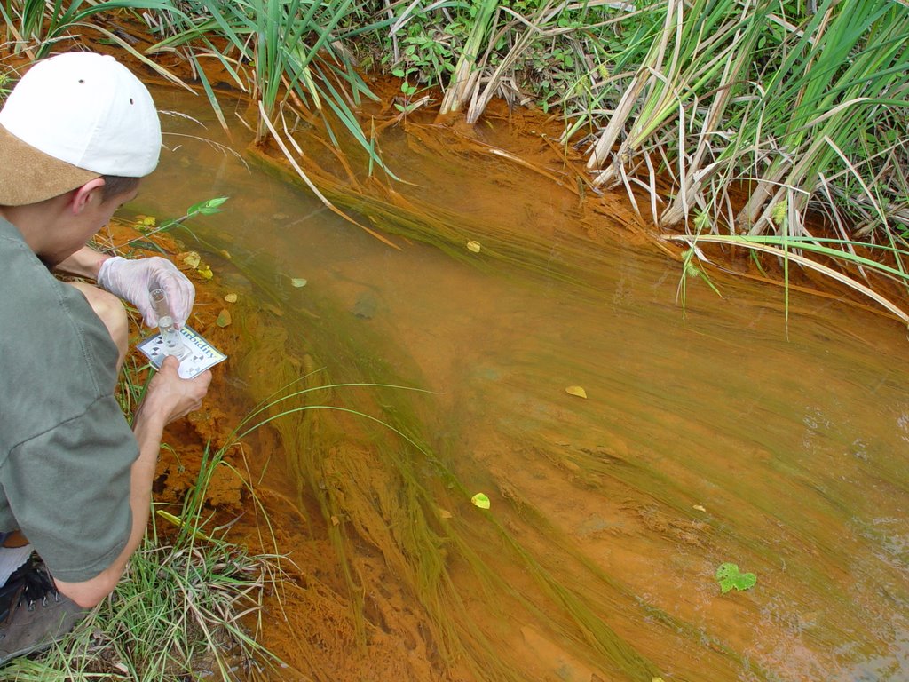
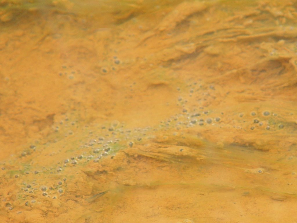
Appearance: Water is cloudy, sedimented at bottom. There is some floaty neon orange foam on top of water. There is also a good deal of long- stemmed underwater moss-type plant growing. Some garbage in the water.
Animals: frogs
Plants: wild roses, mimosa, kudzu, jopie weed, cat tails, honeysuckle,
Mileage: 101,761
Note: There is a noticeable sewage like smell near the water
Site: DD
Bottle: DD
Pictures: 42-44
GPS Coordinates:
Speed: 0.5
Temperature: 22 C
Turbidity: 50 JTU
Location: 1 mile South on 27 from Junction with 63 before the New River Missionary Baptist Church. River passes under the road.


Appearance: There is some neon orange floaty foam in spots. Water is otherwise fairly clear, bottom is sedimented.
Animals: none noted
Plants: tulip poplars, 3 foot tall wild onions, jopie weed
Mileage: 101, 764
Note: This sample was taken down river from the bridge because the other side was inaccessible.
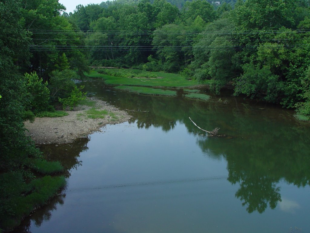
Site: DE
Bottle: DE
Pictures: 45-48
GPS Coordinates: N 36 deg 22.933
W 084 deg 33.252
Alt 1190
Speed: 0.5
Temperature: 26 C
Turbidity: 5 JTU
Location: Approx. 2.5 miles South on 27 from Junction with 63. Stop at “Colonel Joe Cecil Bridge” over the New River. It is passed mile marker number 9.
Appearance: the water is green but fairly clear.
Animals: people were fishing
Plants: poison ivy, lots of shrubs, heart-shaped-leaved tree
Soil: very dry sandy soil, beach like on the banks of the river
Mileage: 101,766
Site: DF
Bottle: DF
Pictures: 49
GPS Coordinates: N 36 deg 19.920
W 084 deg 36.500
Alt 1187
Speed: 0.5
Temperature: 28 C
Turbidity: 15 JTU
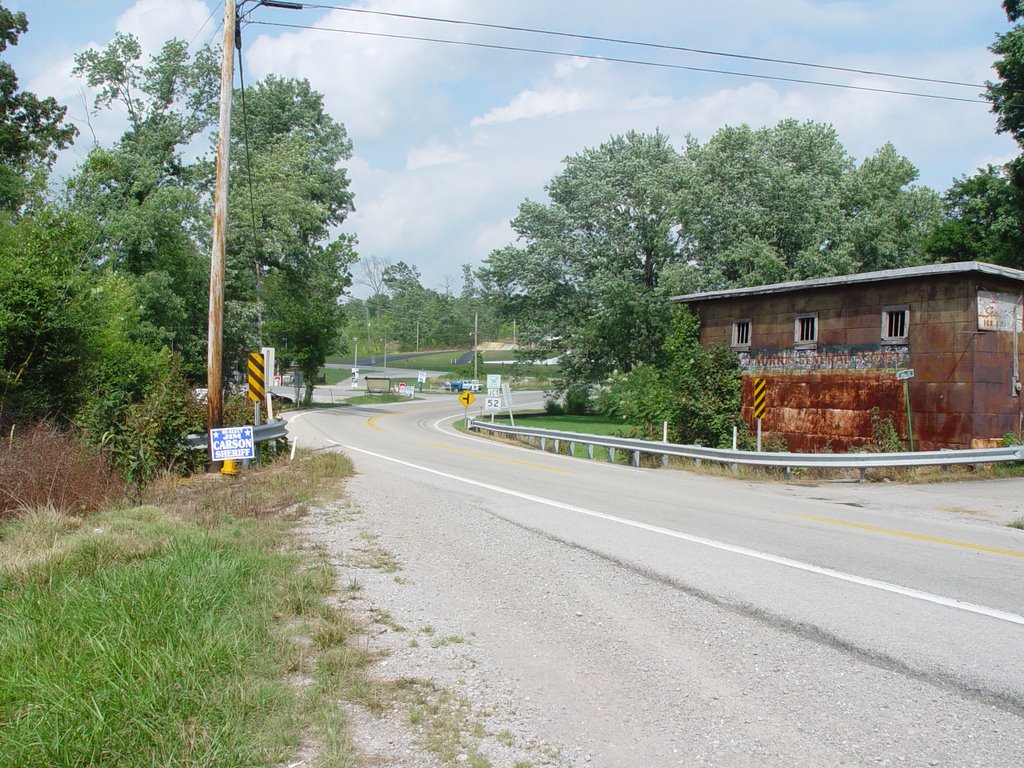
Location: On 27 South near Robbins. Pulled over directly before “Sunbright 9” sign at the intersection of 27 and High Street.
Appearance: Stream passes under the road, but one side is dry and the other is nearly stagnant.
Soil: muddy and stagnant smelling
Animals: tadpoles, minnows, little underwater snake
Plants: alderbush, maples, lots of dead grass on the bank and some in the water
Mileage: 101,771
Site: DG
Bottle: DG
Pictures: 50-51
GPS Coordinates: N 36 deg 19.316
W 084 deg 36.744
Alt 1240
Speed: 0
Temperature: 24 C
Turbidity: 15 JTU
Location: On 27 South, pulled over before Wolf Creek Road. Approx. 6 miles down 27 from Junction 63 and ½ mile South of site DF
Appearance: water is clear, but stream is heavily sedimented. Stream is overgrown with bushes. There are dead grasses on bank and near the road.
Animals: black flies, red centipede, winged leech
Plants: butterfly bush, jopie weed, long-needled fir tree, sumac, wheat, black berries
Mileage: 101,772
Site: DH
Bottle: DH
Pictures: 52-end of card #1
GPS Coordinates: N 36 deg 18.998
W 084 deg 37.521
Alt 1337
Speed: 0.5
Temperature:
Turbidity:
Location: At Wolf Creek, running under 27 South approx. 10 miles south of Junction with 63.
Appearance: Concrete bridge beams right in the water. There is a wetland type area to the left of the road near the creek. Water is brown and very cloudy in some spots. There is green floaty algae as well puffy blackish algae growing on underwater rocks. There is dead grass on bank and near road.
Animals: turtles in wetland according to local, bull frog, pigeon, lots of 3 inch fish, waterbugs
Plants: elder berry tree, water grasses, jopie weed
Soil: mucky, lots of rotting leaves in the soil
Mileage: 101,773
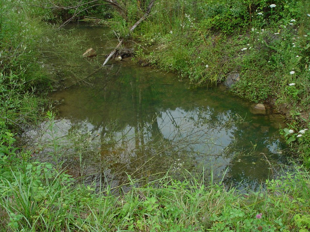
Site: DI
Bottle: DI
Pictures: 1-4 of card #2
GPS Coordinates: N 36 deg 19.248
W 084 deg 30.578
Alt 1192
Speed: 0
Temperature: 24 C
Turbidity: 5 JTU
Location: Off Brimstone Road, approx. 3 miles after T-intersection where we took a Right. There is a small bridge and gravel road that goes off to Left of Brimstone Road.
Appearance: Water passes under the road, running South, Creek has gone dry on one side of the road. On the other side, the water is low but the water is clear and there is little sediment on the bottom. There is some bright green algae gunk in spots on top of water. There is dead grass on the bank.
Animals: minnows, brown butterflies,
Plants: mullen, Queen Anne’s Lace, ragweed, mimosa, princess tree, wild roses, Johnson grass, polk berries,
At site DI there is a gravel road opposite the bridge. Follow this gravel road to old inactive mine site, about 3-4 years old according to local person. There is a sediment pond on right hand side as well as some evidence of a landslide. Much sirosa weed grows along road, a weed the plant to “reclaim” mine sites. Coordinates from mine site are N 36 deg 19.136, W 084 deg 29.458, Alt 1390. Pictures 7-12.
Site: DJ
Bottle: DJ
Pictures: 18-22
GPS Coordinates: N 36 deg 16.754
W 084 deg 29.611
Alt 1350
Speed: 1.5
Temperature: 24 C
Turbidity: 5 JTU
Location: Gravel road off Brimstone Road. After making Right at T- intersection on Brimstone, we crossed a big bridge after site DI, directly after bridge there is a gravel road on the left hand side, We traveled about ½ mile up gravel road to collect sample DJ from creek running on left hand side of the road.
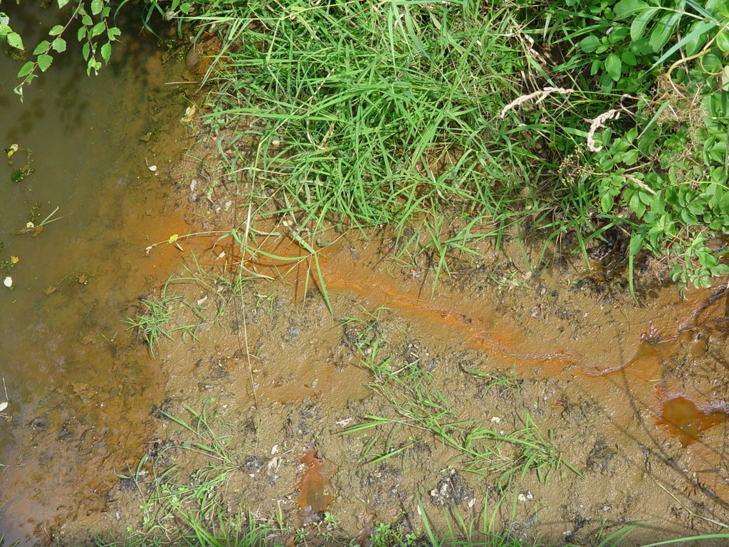
Appearance: Water is clear and moving at good, steady speed. There is some garbage in the water.
Animals: minnows, 3 inch fish
Plants: maples, poplars, bushes and shrubs
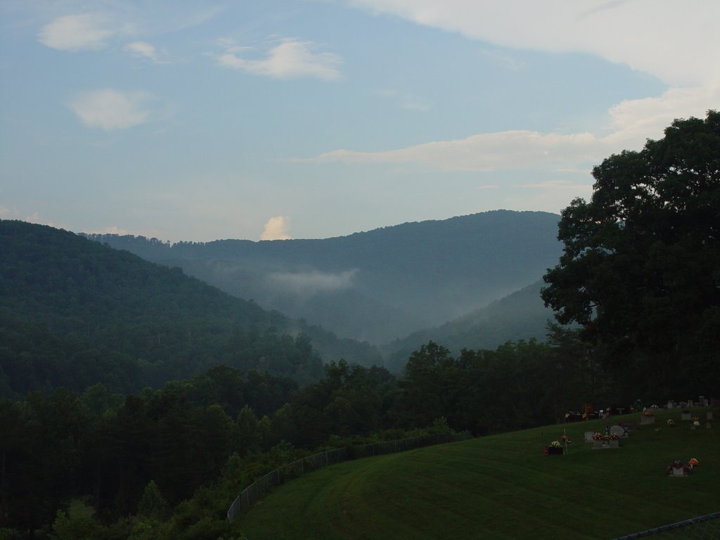
We stopped at Love Mountain Missionary Baptist Church to take some pretty pictures of the mountains (pictures 23-27).
Clear cuts visible from friend’s property. Site was cut within the last month and is roughly 30-40 acres of forest totally clear cut.
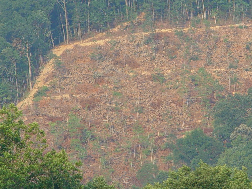
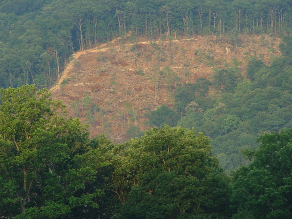
Pictures are taken from
N 36 deg 16.754, W 084 deg 29.902, Alt 1437. Pictures 28-33
posted by petunia @ 7:38 PM
0 comments
![]()
